No Road!
No road through St. Catherine’s Park!
They say that every problem looks like a nail when the only tool you own is a hammer. This is especially true when a road engineer is asked to draw lines on a map connecting two dots. It won’t come as any surprise when those lines tend to join up those dots in relatively straight lines.
And so it seems our wonderful St. Catherine’s Park remains in the crosshairs of those who would seek to join up the M4 and M3 motorways.
The dots of choice currently are Junction 5 on the M4 between Leixlip and Lucan, and somewhere near Clonee on the M3. This link road has been an objective of Fingal Co. Co. for years. Indeed, they have ‘sterilised’ the route corridor, which in planning terms means they have avoided any other development on this chosen route. The original ‘route’ is hard to find these days: it used to run directly north of Junction 5, right through the heart of St. Catherine’s Park, taking out historic buildings and landing more or less where the popular dog park is today. Then it continued north through the park and over the canal towards Meath.
It would seem that this road proposal was becoming unpopular within some sections of Fingal, and more recent pressure was brought to bear on Kildare Co. Co., and so this deeply unpopular road proposal suddenly found itself swinging left as it crossed the Liffey Valley, shooting over the historic Black Avenue, and landing in the section of the park managed by Kildare, taking out all our playing pitches. Thus neatly avoiding doing any damage to the Fingal part, and letting them off the hook of what they know would be massive public outrage. (This was even admitted to some members of our group, off the record, by a senior planner. Would they go on the record today, to repeat this? I doubt it.)
Kudos then, to the unanimous decision by all Fingal councillors in 2017 to remove this road from the Fingal Development Plan. But no equivalent respect was shown by the unelected officials in the executive who chose to ignore this democratic wish. No; they chose instead to keep this road on their plan, and it remains there to this day, and appears once more as one of their current objectives (Objective CMO37c: Support and facilitate the TII, NTA, Meath County Council and Kildare County Council in the planning and delivery of a new link between the M3 and M4).
The deeply unfunny part to all this knockabout political farce is that Kildare Co. Co. have to date flatly rejected this proposed road, even to the extent of stating it clearly in their own development plan (Chapter 5 on transport: M O 70: Protect the amenity of St. Catherine’s Park, no road proposal shall be considered by this Council through the park within the Council’s ownership or jurisdiction.)
So there is clearly a deep contradiction here, which remains unresolved. But fans of new roads need not despair, because the knight in shining armour that may yet ride in to the rescue is the TII (Transport Infrastructure Ireland). Once a project reaches the level of ‘national interest’, it supersedes local authority control.
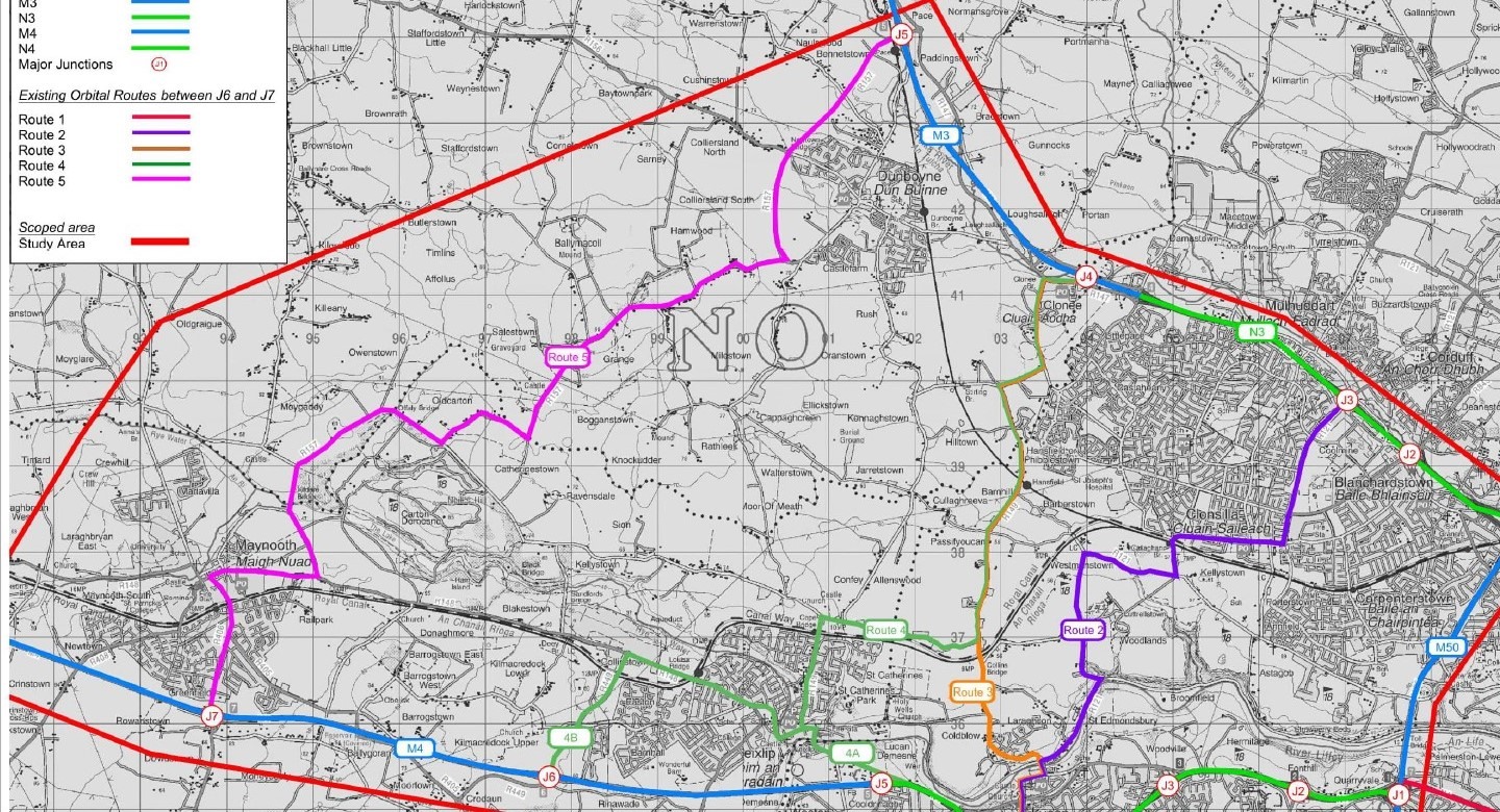
The TII have scoped the area in recent years. Road engineers looked at 11 options to join up these two motorways, and three of these options went through St. Catherine’s Park. (Enhancing Motorway Operation Services: M50 Traffic Flow Optimisation. M50 Resilience between M50 J6 and J7: N3 to N4 Link. May 2019).
Look, let’s be honest. A road of this size is not going to be easy to build. Nor cheap. Something has to give. The rationale for building it, as far as the TII is concerned, is to provide ‘resilience’ for traffic movements north and south. An accident on the M50 can cause traffic chaos. Of course, there would be other uses for such a road, and only a fool would assume that such a road would not open up the lands north of St. Catherine’s Park to development. Anyone who travels this area knows that much of this land has been sold in recent times. It is, to use estate agent parlance, ‘ripe for development’. And of course, Confey is very much part of Kildare Co. Co.’s plan to increase the population of north Kildare. This will heap massive pressure on all the usual infrastructure that seems to be under strain as never before: roads, obviously, and schools. Drinking water, and waste water disposal. Electricity and broadband. Flooding is another issue. It’s a well-worn list.
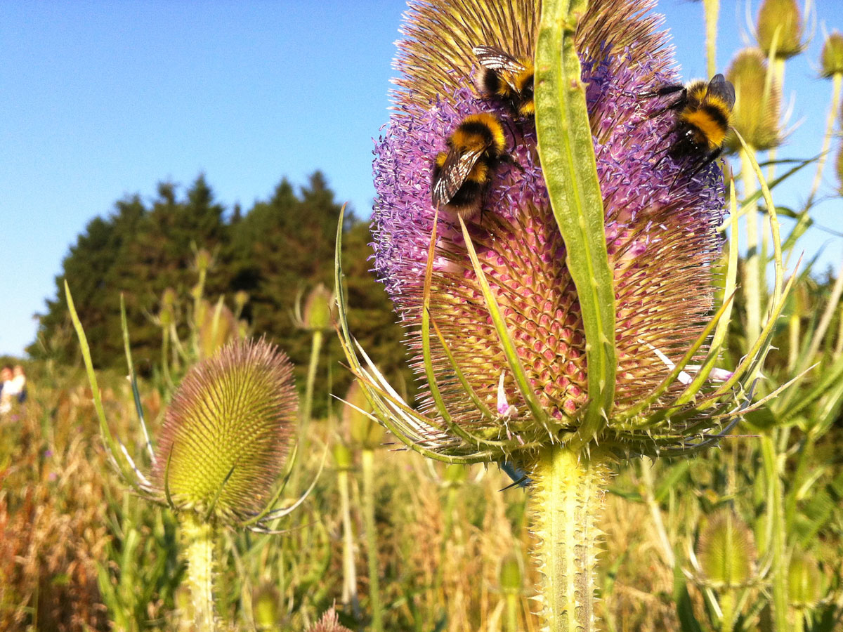
Which brings us back to my first point. One of the critical pieces of ‘infrastructure’ when we think of development is not infrastructure at all. It is ‘amenity’. It’s a phrase tossed around like snuff at a wake in county development plans. And always with fabulous pictures of wildlife.
And so let us take another look at the hugely populated area west of Dublin, and into north Kildare, and ask ourselves a different question.
Let us task those in power to find us 200 acres of beautiful parkland. One that has a deep history and connection with the landscape. One with a rich heritage. One with remnants of ancient woodland. Preferably with a river and a weir for canoeing. And how about throwing in access to Ireland’s longest cycling greenway along the Royal Canal? For the kids, make sure there’s a great playground, and for the sports enthusiasts, plenty of pitches. And how about a BMX track? And a hugely popular dog park?
What’s that you say? It’s already there?
You’re right. It is. It would be impossible to purchase such a facility today. Impossible.
And so it seems incredulous that any state agency would seek to deliberately damage and destroy such a popular amenity. I find it hard get my head around it. But here we are. Hammers and nails. I think we need to take the hammers away from these people before we lose a precious and irreplaceable source of beauty. But we keep asking the wrong people the wrong questions. And we keep getting the wrong answers.
What can you do?
Make your feelings known to Kildare County Council on the proposed new development plan. Go to https://consult.kildarecoco.ie/ for more information. Make sure you submit your views by 4.00pm on Thursday 27th October 2022. Say what you wish, of course. If you want to save your park, let them know in no uncertain terms that you do not want any roads through St. Catherine’s.
You can also let Fingal Co. Co. know your opposition too. And the TII. But if anyone thinks St. Catherine’s is safe, they are wrong. And don’t let any politician fool you on this either. One thing you can say about road engineers: unlike some politicians, they tend be (like the roads they build) fairly straight.
(As appeared in The Liffey Champion newspaper, 15th October, 2022)