St. Catherine's Park
Variable throughout the year, but always open to pedestrians. Car traffic should pay attention to closing times to avoid getting locked in to the park.
St. Catherine’s Park dates back to the time of the Anglo-Normans in Ireland. In 1219, the Norman landowners, Warrisius de Peche, of the Manor of Lucan and Adam de Hereford, Lord of Leixlip, (Strongbow’s right-hand man, and the Norman knight responsible for the construction of Leixlip Castle in 1172) granted to the brethren known as the order of the canons of St. Victor, the lands of St Katherine’s.
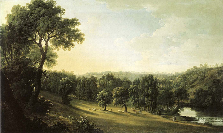
Lucan Demesne, by Thomas Roberts, a painter working in the mid-to-late 1700s
They were to build a priory and on parcels of adjoining land they had permission to collect wood, graze cattle and to construct a mill with a weir on the Liffey. By 1332, St. Katherine’s had passed to St Thomas’s Abbey and until 1530 was under their control.
Through a series of grants, gifts and leases, it returned to the possession of the laity, one of whom was the family of the original grantor, Sarsfield, whose descendants continued to hold part of St. Catherine’s until the early twentieth century.
While St Catherine’s had always been in two portions, one being the deer park shown on maps as a wooded area and the other open fields, it wasn’t until the mid-eighteenth century that the deer park of St Catherine’s was leased away from St Catherine’s as a separate parcel of land by a member of the Trench family.
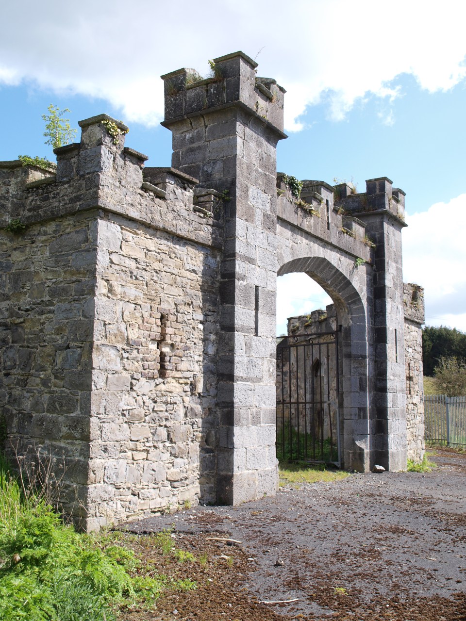
Gate designed by Francis Johnston
The park remained in private ownership. In 1798 (the year of the ’98 Rising), a new house was built, called St. Catherine’s Park, to the design of Francis Johnston. This was to replace one burnt down. He also designed the gate which can still be seen in the park today. The house is currently a hotel.
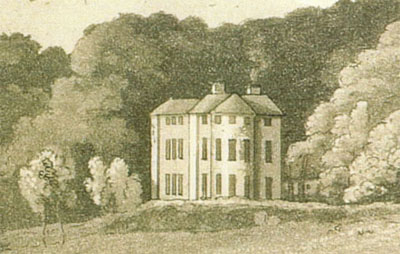
St. Catherine’s Park house, circa 1792
The lands around St Catherine’s continued to be farmed, and if we roll the clocks forward, we arrive to more recent times when the land was used by UCD (University College Dublin) as a horticultural field station. Many Leixlip locals have fond memories of working in the fields and orchards in recent years, picking various fruits and vegetables.
After a failed attempt to get much of the land rezoned for housing by three land owners – an attempt that sparked a massive campaign to stop the rezoning – the state stepped in and purchased the bulk of St. Catherine’s Park to be used as a public amenity. Here is a newspaper report from the time.
There are some good quotes in there, such as this on:
Mr Austin Currie, Minister of State for Health, welcomed the announcement, hoping that the demesne “will form the basis of a Liffey valley national park as pledged in the Programme for Government”.
and also
The land “can now be incorporated into the overall strategy for the conservation and preservation of the Liffey valley as a national amenity”, he said. [Mr Liam Lawlor, the Lucan based Fianna Fail spokesman on arts, culture and the heritage]
The purchase of the land was authorised by then Minister for Arts, Culture and the Gaeltacht, one Michael D. Higgins, our current President. There are three local authorities which have responsibility for the upkeep of the park: Kildare, South Dublin and Fingal. The river is the boundary between the two Dublin councils and the road up to the car park from the Black Avenue (beside the holy well) is the boundary between Kildare and Fingal. This county boundary extends north through the park, following a line of poplar trees.
